Pernik Peninsula
Koordinatar:
| Pernik Peninsula | |
| halvøy | |
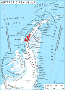 Plasseringa til Loubet Coast på Den antarktiske halvøya. | |
| Land | |
|---|---|
| Stad | Ellsworth Land |
| - koordinatar | |
| Administrert under | Antarktistraktaten |
 Pernik Peninsula (Antarktis) | |
Pernik Peninsula (bulgarsk полуостров Перник, ‘Poluostrov Pernik’) er ei isdekt halvøy som strekkjer seg 40 km nordvest frå Loubet Coast på vestsida av Den antarktiske halvøya. Ho grensar til Darbel Bay i nordaust, Lallemandfjorden i vest og Crystal Sound i nordvest, og den nordlege delen er dominert av Protector Heights.
Halvøya er kalla opp etter byen Pernik vest i Bulgaria.
Kjelder |
Bulgarsk antarktisk stadnamnregister. Antarctic Place-names Commission. (detaljar på bulgarsk, grunnleggande data in English)
SCAR Composite Gazetteer of Antarctica.


