Bomb Peak
Koordinatar:
| Bomb Peak | |
| fjell | |
| Land |  Antarktis Antarktis |
|---|---|
| Topp | Ross Island |
| - høgd | 805 moh. |
| - koordinatar | |
| Administrert under | Antarktistraktaten |
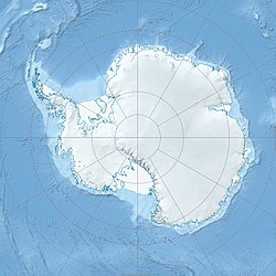  Bomb Peak (Antarktis) | |
Bomb Peak er ein fjelltopp, 805 moh, som ligg 2 nautiske mil vest for Cape Crozier på Ross Island. Det vart kartlagd, og fekk dette namnet av New Zealand Geological Survey Antarctic Expedition, 1958–59, på grunn av bombeliknande (pyroklastiske) geologiske formasjonar kring toppen av denne toppen.[1]
Kjelder |
↑ «Bomb Peak». Geographic Names Information System, U.S. Geological Survey. Henta 25. oktober 2012.
Kjelder |
 Denne artikkelen inneheld stoff som er offentleg eige frå United States Geological Survey-artikkelen «Bomb Peak» (innhald frå Geographic Names Information System).
|


